If you are picturing a place to hunt, fish, hike, or unplug for the weekend without leaving the Kansas City metro, Jackson County offers real options. The key is knowing how to evaluate a tract so you protect your time and money. In this guide, you will learn the practical steps to confirm access, understand soils and water, evaluate utilities and zoning, and explore income opportunities like leases or MRAP. Let’s dive in.
Confirm access and title first
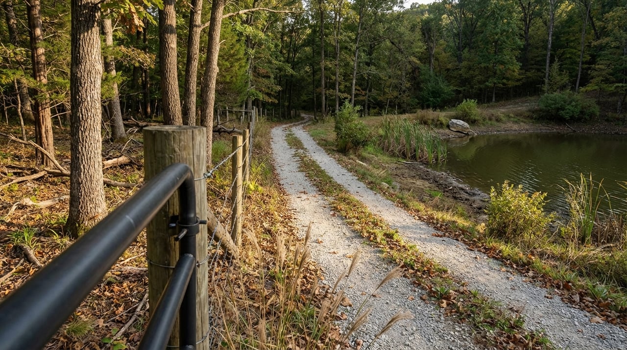
Before anything else, verify that you have legal, workable access. Start with the county’s parcel viewer to see boundaries and roads, then remember that GIS layers are illustrative and not proof of title. Use the Jackson County Parcel Viewer to locate the tract and orient your map work. From there, order a title report and an ALTA/NSPS survey to confirm recorded easements, road status, and any maintenance agreements.
If a parcel appears landlocked and access negotiations fail, Missouri law allows a court-ordered private road where strict necessity is proven. A real estate attorney can advise you on options and timing. Clear, recorded access is the single biggest factor that protects value and usability.
- Start here: the Jackson County Parcel Viewer shows parcel lines and layers you can use for early screening. Visit the Jackson County Parcel Viewer.
Map topography and soils
Topography shapes everything from trail routes to driveway feasibility. Pull USGS topo to spot ridgelines and draws, then overlay your ideas for cabins or campsites. Next, run the NRCS Web Soil Survey for a parcel-specific soils report. This will flag hydric or erosion-prone soils, septic suitability, and areas better suited for structures, trails, or food plots.
- Visualize slope and drainage with USGS topo maps.
- Screen soils and septic suitability with the NRCS Web Soil Survey.
Check water and flood risk
Creeks, ponds, and wetland pockets add recreation value, but they can limit building or drive placement. Confirm whether any portion of the land falls within a FEMA flood zone, since that affects insurance and permits. Use FEMA’s mapping resources and local floodplain overlays as your baseline.
- Review FEMA flood resources through this federal register index of map updates, then contact the local floodplain office to confirm.
If a pond or creek is central to your plans, ask about setbacks and any local rules tied to riparian areas. Always pair desktop review with boots-on-the-ground inspection during due diligence.
Clarify utilities, wells, and septic
Find out early if your tract connects to public water or sewer, or if you will need a private well and on-site system. For private wells, request historical well records and plan a water test. For septic, consult local permitting and use your soils report to guide siting. Budget for inspections and potential upgrades if systems are older.
- Learn essentials for private wells and on-site systems from University of Missouri Extension.
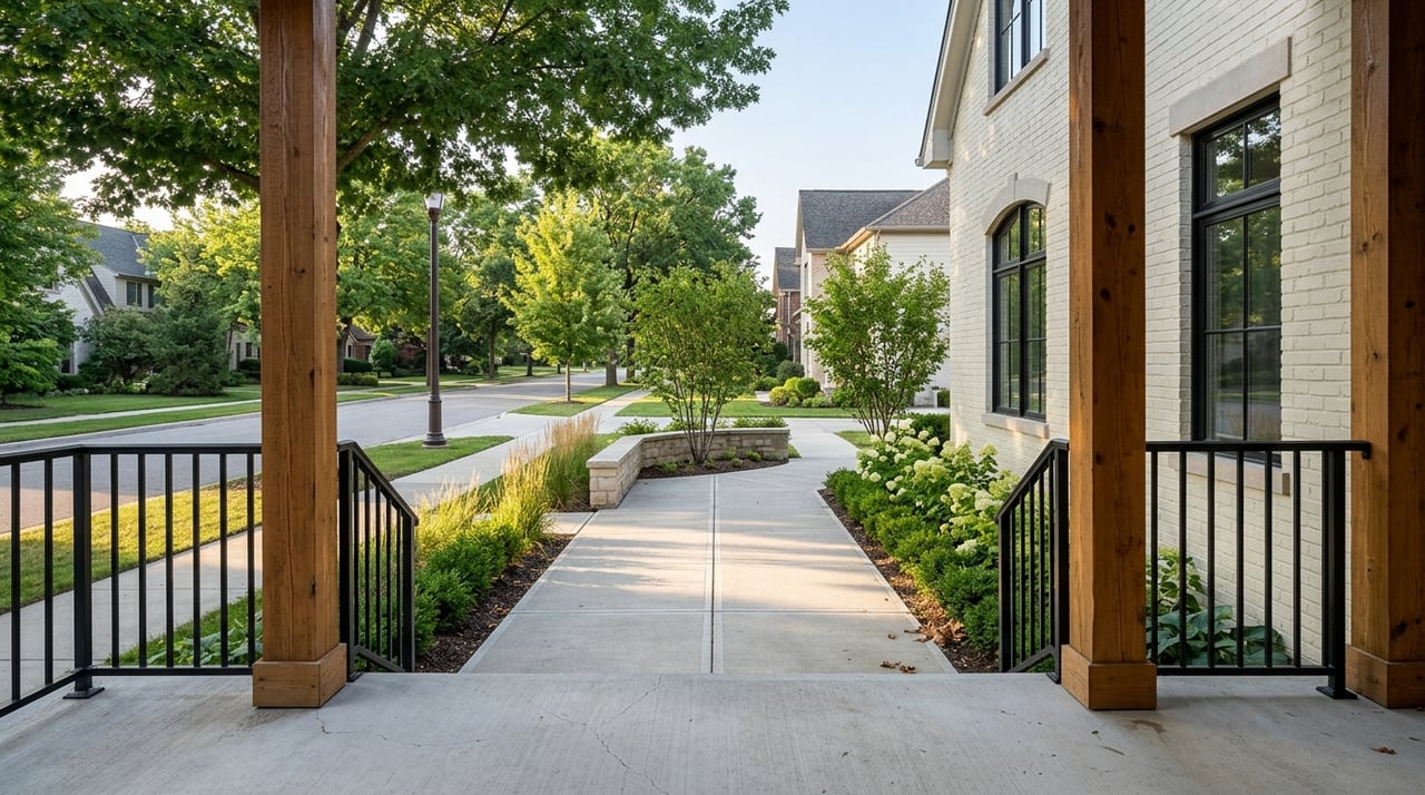
Understand zoning and jurisdiction
Whether the land sits inside a city limit or in unincorporated county territory changes what you can build and how you permit it. Confirm the jurisdiction on the parcel viewer, then call the relevant planning and building departments about permitted uses, setbacks, and any lot-split rules. Do not rely on assumptions or hearsay. Get answers in writing when possible.
Evaluate timber and habitat value
Much of Missouri supports oak and mixed hardwood stands. Timber value depends on species, log quality, accessible volume, and haul distance to mills. If timber is part of your value story, ask an MDC forester or a consulting forester for a timber cruise and sale advice. Expect price variability and gather multiple bids before you sell.
- Use MDC’s regional Timber Price Trends as a market reference: Missouri Timber Price Trends.
Explore income opportunities
Recreational tracts can produce modest income that helps offset taxes or fund improvements. Consider these options once access, zoning, and basic suitability look solid.
Hunting leases
Written hunting leases are common in Missouri and should spell out species, access, vehicles, and improvements. Recent statewide survey results reported average hunting-lease rates around 21.45 dollars per acre for any wildlife and about 1,667 dollars per hunter per year. Actual rates vary with habitat quality, parcel size, and proximity to the metro.
- Get lease structure guidance and benchmarks from MU Extension’s hunting lease guide.
Timber sales
Timber can be a meaningful line item, but only with good information. Use a professional cruise to estimate volumes, then compare against regional price trends. A competitive or sealed-bid sale often yields better results than a single offer. Build harvest rules into your plan to protect trails, streambanks, and future aesthetics.
- Reference regional price signals with Missouri Timber Price Trends.
MRAP and managed public access
Missouri’s MRAP program pays landowners who open eligible tracts for managed public access. Payments depend on acreage, habitat, and program option. Some landowners use MRAP to monetize low-impact access while maintaining control through program rules. Missouri law provides limited protections when allowing free recreational use, so read program terms before enrolling.
- Explore eligibility and incentives on the MDC MRAP page.
Agricultural or grazing rentals
If portions of your land are tillable or pasture, a short-term ag or grazing lease can add steady income. Rates vary by quality and location, so combine a local comp check with statewide benchmarks.
- Use MU Extension’s cash-rent survey as a benchmark: Missouri cash rent guidance.
Watch local market signals
Jackson County sits inside the Kansas City metro, so land and residential values move with regional demand. Instead of relying on statewide averages, look up current assessed values and recent sales data before you set expectations. Pair county records with MLS comps for a realistic price view of nearby tracts.
- Start your lookup on the Jackson County property and assessment portal.
Step-by-step due diligence
Use this checklist to move from interest to confident offer:
- Pull the county parcel record and GIS layers. Confirm owner, lines, and any scanned documents. Use the Jackson County Parcel Viewer.
- Order a title commitment and an ALTA/NSPS survey that shows recorded easements, road status, and any gates or private roads.
- Run NRCS Web Soil Survey and USGS topo for slope, drainage, and septic siting clues.
- Check FEMA flood resources and ask the local floodplain office about any overlays or permit limits. Start with this index of FEMA mapping updates.
- If timber or hunting value matters, schedule a forester visit and discuss programs or permits as needed. Use Timber Price Trends as a reference.
- Add contingencies for access, soils and septic suitability, well test, timber appraisal if relevant, and any wetland or environmental review.
What to include in your offer
Protect yourself with clear contingencies and deliverables. Require a current survey and title insurance. Add time for well and septic inspections, soils review, any timber cruise, and a floodplain check. Make the offer contingent on securing or confirming a practical, recorded access route.
How we help you buy with confidence
Buying recreational acreage is equal parts lifestyle and due diligence. You deserve a partner who knows the county tools, the habitat variables, and the local market. Our family-led team brings deep Kansas City roots and hands-on land experience across Jackson, Johnson, Cass, and Miami Counties. From parcel pulls and mapping to coordinating foresters and surveys, we help you see the full picture so you can buy with confidence.
Ready to evaluate a Jackson County tract or want a second opinion on one you have in mind? Reach out to Dana Benjamin for a friendly, no-pressure consult and a clear action plan.
FAQs
How do I confirm legal access to Jackson County land?
- Start with the Jackson County Parcel Viewer, then order a title report and ALTA/NSPS survey to verify recorded easements and road status. If a tract is landlocked, a Missouri attorney can advise on easement or private-road remedies.
What maps should I pull before walking a property?
- Combine USGS topo for slope and NRCS Web Soil Survey for soils and septic screening, then check FEMA flood resources using this federal register index.
How do I estimate timber value in Missouri?
- Get a forester-led timber cruise and compare to regional signals in Missouri Timber Price Trends. Always solicit multiple bids because stumpage varies by species, quality, and access.
What are typical hunting lease rates in Missouri?
- MU Extension’s recent survey shows averages of about 21.45 dollars per acre and roughly 1,667 dollars per hunter per year, with wide variation by habitat and location. See MU Extension’s hunting lease guide.
Can I earn income by opening my land to public access?
- Yes, Missouri’s MRAP pays eligible landowners who allow managed public access, with payments tied to acreage, habitat, and program option. Review details on the MDC MRAP page.